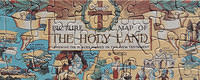
Picture Map of The Holy Land
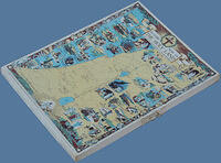
An interesting cardboard puzzle, probably of 1950's manufacture and which uses a smaller scale, more colourful version of a wall map still available today.
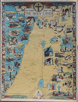
The map "showing the places named in the New Testament", has an index along the bottom identifying the various places and events leading from Nazareth, prior to the birth of Jesus, through to His ascension from Bethany.
In the lower right corner is the name Lawrence Stone. A little research has identified him as a somewhat controversial English Historian (1919-1999), whose main works revolved around Britain, so this seems something of a diversion. Whether he was the artist of this work, or assisted with its layout and detail is not known.
Artist: Stone, Lawrence?
Date: c1950's?
Brand: Francis Chichester
Material: Cardboard
Nationality: British-England
Pieces: 200
Size: 11" x 16 1/2"
Theme: Maps
Title: Picture Map of The Holy Land


© 2008-2025 David Shearer
Album info
Album Tree
Random image
